


The Missouri River flowing through the Missouri Headwaters State Park in Three Forks, Montana
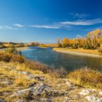
The Missouri River flowing through the Missouri Headwaters State Park in Three Forks, Montana.
“If you have a milkshake and I have a milkshake and I have a straw,” fictional early 20th-century oilman Daniel Plainview explains to preacher Eli Sunday in the 2007 film There Will Be Blood. “And my straw reaches acroooooss the road and starts to drink your milkshake,” Plainview continues, reaching his arm out, pointing his finger down into the unseen earth and stalking across the room toward his guest, “I drink your milkshake. I drink it up!”
Plainview is talking about oil, but the theory applies just the same to water. It’s not a new idea, yet it is one we persistently forget, or fail to apply broadly enough. In Jefferson County and beyond, the milkshake problem looks set to emerge as the defining issue of the coming decades, underscoring how the region, and even the state, slurp from the same finite pool.
“This analogy gets used a lot and it’s coarse, but it is illustrative of a thing that happens,” Stan Bradshaw, a retired water attorney who argued cases for the state and the advocacy group Trout Unlimited for decades. “The phenomenon is real…I have seen instances where surface water flow is heavily influenced by either the lack or loss of groundwater within the system.”
Locally, we might start in Clancy, where a 110-home district has been seeking a reliable water source for more than a decade. Joel Pilcher, an engineer until recently with Great West Engineering, worked on the project for 10 years. If the latest promising well fails to deliver, he expects the town’s water board to approve one more round of test drilling.
After that, any potential new well would likely be too far away from the target district, making it prohibitively expensive. “Are we going to build a pipeline to Helena?” Pilcher joked in a recent interview. “At some point it gets to where it’s not feasible.”
Might the recent housing boomlet in neighboring Montana City be milkshaking Clancy’s high-quality water? It’s a possibility, but impossible to say for sure given that few studies have examined how much water one place loses when its neighbor starts using more.
John LaFave, interim director of the Montana Bureau of Mines & Geology (MBMG) and one of the state’s most insightful observers on these issues, has overseen a couple of those analyses. He pointed out that Western Montana’s many mountains mean the milkshake theory may have only limited application for its aquifers. “They are renewable in the sense that we get this dump of snowpack every year,” he said. “So it does get recharged.”
LaFave also presented a primer to make a counterpoint. An aquifer is an underground layer of permeable sand, gravel, or rock that stores and transmits groundwater. In our region, streams are mostly groundwater discharge areas, gaining flow from aquifers, while irrigation canals “leak” water into the aquifer during conveyance, providing recharge, much as a pool of water at the beach will slowly seep into the sand.
Thus, as land shifts from agricultural use to housing, new wells mean increased residential consumption plus the loss of the canals. “If we take these irrigation wells out of production, we’re cutting off a source of recharge to the aquifer that’s been there 100 years,” said LaFave. “It’s kind of a double whammy.”
Some fear this could soon happen in Boulder, which began selling bulk water in August. City officials say the sales revenues will ultimately save Boulder residents money, with ongoing system upgrades expected to spur water rate increases. Yet the Smith and McCauley families – Boulder-area ranching clans for generations – take a different view.
Brady Smith worried about the depletion of Boulder’s aquifer and, in a Monitor article, proposed the creation of a water advisory board to review all relevant city decisions. Edward McCauley filed a complaint with the state Department of Natural Resources and Conservation detailing his concern that city wells connect to the town aquifer and feed into the Boulder River and Muskrat Creek, ensuring a broader impact.
“There is currently insufficient flows to accommodate the complainants’ water rights,” McCauley informed the state, “and at a critical time.”
A 2021 DNRC and Bureau of Reclamation study of water supplies and allocation around the Missouri Headwaters and its tributaries asserted that continued rapid population growth, a warming trend, and expanded agricultural usage would drive increased water demand. The report splits the Headwaters region into four districts and for Jefferson County’s worried that the “irrigation water shortage may increase for most irrigators.”
Ranchers south of Boulder may be nearing peak water. Montana Fish, Wildlife, and Parks has labelled the Boulder River south of town “chronically dewatered,” as it often dries up in the summer. And just this month, the Jefferson River Watershed Council announced a new initiative for the Boulder River watershed that seeks to bring together local observations, scientific data and technical analysis to devise a comprehensive restoration plan.
Boulder Valley aquifers tend to be embedded in sand and gravel and quite productive, according to LaFave, but that changes as one moves into the foothills and mountains. “If you drill a well there you’re going to be in hard rock, where there’s only space for water in the cracks and fractures,” he said. “Those aquifers are much more susceptible to depletion.”
A 2017 MGMB modeling study of the Boulder River watershed found that area stream flows do fluctuate in proportion to groundwater consumption, and that proximity is meaningful. The study showed that depletions resulting from the addition of a modest, 128-home subdivision “are relatively small compared to surface-water irrigation diversions.” After 20 years, that development would reduce volume by .06 cubic feet per second, or .4% of the total flow.
But multiply this impact by 10 or 100 for a much larger residential project. How might a 10% reduction in area stream flows affect local users? “The question should be, what as a society should be allowable in terms of the water pumped,” said LaFave. “Maybe we’ll allow one percent of baseflow to be used by local residential development.”
Beyond that, LaFave feared troubling impacts, such as less water for irrigation. Echoing this, the 2017 Boulder watershed study concluded that larger residential developments, particularly with smaller lots, would have greater impacts on area groundwater and stream flows.
This is an apt description of Habitat for Humanity’s 1500-home Rose Hills development plan for East Helena. With cottages, townhomes, and small-lot single-family homes – up to 40% of which will be permanently affordable through a land trust – the project seeks to squeeze lots of “missing middle” housing into a small footprint.
East Helena’s City Council unanimously approved the plan in late October, the day before Lt. Gov. Kristen Juras denied the city’s request for water rights on the former ASARCO smelter lands where Habitat hopes to build. Another developer, Oakland, hopes to build 4500 homes nearby and expects to submit its proposal to the city in 2026.
Most residential developments have not led to depletion, according to LaFave, though some have in the Helena Valley. This suggests that more subdivisions in the Helena Valley and the 6000 homes planned for the former ASARCO lands could result in troubling depletions.
“Where is all of this water going to come from?” East Helena resident Larry Krum wondered aloud at a recent water event. There’s a chance it may not come at all, given that the state now plans to transfer the former ASARCO water rights to instream flows to protect fish in Prickly Pear Creek, which flows through the property area for development.
On East Helena’s northern rim, residents of The Prestige at Red Fox Meadows are in crisis after the state informed them that homes in the subdivision must find a new water source. Their development had been allocated exempt wells, a practice essentially barred by a February 2024 court decision involving a development in Broadwater County.
Bradshaw, the water lawyer, believes the recent state decisions to essentially end the use of exempt wells for subdivisions and deny East Helena the water rights for former ASARCO lands reflect growing concern at the state level for broader regional water supplies.
“The DNRC decided back in the 80s or 90’s that groundwater surface water connections were more tenuous than some signs indicated,” he said, adding that this view had begun to shift. Officials now see “it’s death by a thousand straws, as you accumulate enough,” he added. “If you see a lot of residential development, you could ultimately see a connection to flows dropping.”
East Helena Mayor Kelly Harris’ view is that the state sees the former ASARCO water rights as part of a broader assessment of water in the Upper Missouri region. Early this month he told me the state is working to expedite that review, but “it’s complicated.”
You can say that again. While researching water in this region I could hardly get my head around the countless agency acronyms and long-titled strategy reports, white papers, and scientific analyses. I soon found I was not alone. A 2023 U.S. Geological Survey study examined the Missouri Headwaters Basin’s 40 water institutions, including local, state, and federal agencies, and their grappling with six key laws, seven shifting policies, and at least 12 types of plans.
“The current multilevel governance regime leaves certain aspects of ecologically available water unaddressed and does not adequately account for the interconnections between water in different parts of the ecosystem,” the authors found, highlighting disconnects due to jurisdiction, ecosystem, and species. “Gaps occur when agencies do not recognize the significant connections between management responsibilities, governance mechanisms, and functions of water on the landscape.”
Put another way, when it comes to water we have too many cooks in the regional kitchen, and even the trained professionals responsible for managing and allocating Missouri Headwaters resources have failed to fully grasp the milkshake problem.
Industrial uses may pose another concern. To the east, Butte folk are worried about the water use of a massive new data center, which is expected to require up to 15 million annual gallons for cooling. We’re surrounded, and likely losing more water every day – and we’re far from alone.
This is a problem across the West, at the macro and micro levels. “Property owners in Texas can’t prevent someone next door with a bigger pump and a deeper well from sucking groundwater from underneath their property,” Robert Glennon, University of Arizona law professor and author of a groundwater book called Water Follies, recently told The New Yorker.
Some resource analysts fear “it is only a matter of time until a major U.S. city runs out of water.” Could that city be Helena, or Bozeman? And if so, would Boulder be pressed into duty shipping endless truckloads of water up the interstate? Might the lighting-fast, westward-creeping growth in Belgrade have already eroded water levels in southeast Jefferson County?
If so, one wonders what sort of impact 6000 new East Helena homes a stone’s throw from Montana City might have. It brings to mind the way Daniel Plainview emptied Eli Sunday’s land right under his nose. “Those areas have been drilled,” Plainview tells the young preacher.
“No they haven’t,” says Eli, echoing countless 21st-century folk confident they still have water underneath their feet. Somehow, a property that has never been drilled for water could also be thoroughly emptied of H2O.
“It’s called drainage, Eli,” Plainview explains. “I drink your water. I drink it up. Every day.”
Call it drainage, milkshaking, or hoovering, the reality is that your neighbors may be using up your water as you read this. The crucial questions now are how much do we have left, and how might we best share it.